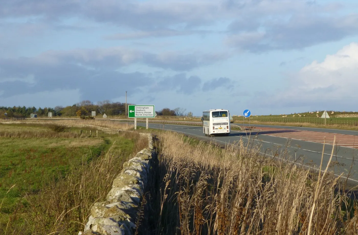

From Monday the B6309 at Stocksfield is shut until 11 December, and the A1 stays 40mph both sides of Morpeth. Every Northumberland closure to 18 October.
The biggest new closure this week is in the Tyne Valley. From Monday 5 October the B6309 south of Stocksfield is closed at all times, for ten weeks, until 11 December. Northern Gas Networks is replacing a steel gas main there. The council’s notice of 1 October confirms the order has been made, so this is no longer a proposal.
On the A1, both speed restriction schemes are still running. The road is 40mph day and night between Seaton Burn and Stannington until around 9 December, and 40mph between Warreners and Earsdon Moor, north of Morpeth, until around 11 December.
The overnight A1 closures have changed shape. National Highways lists the northbound carriageway between Seaton Burn and Shotton shut 20:00 to 06:00 on Sunday 4 October. From Monday 5 to Thursday 8 October it lists slip road closures only, at Seaton Burn, Blagdon and Stannington.
Below is the full Northumberland list: what is shut now, what starts in the next fortnight, what is booked for later in October, the parking changes open to objection, and the Holy Island crossing times to 18 October.
Last checked 4 October 2026 against the council’s statutory notices published on 24, 25 September and 1 October 2026, the National Highways closure report for 2 to 8 October, and the council’s causeway crossing times.
Closed right now
These come from Road Traffic Regulation Act 1984 section 14 notices published by Northumberland County Council and National Highways on the Public Notice Portal. Each notice carries the exact extent, the hours and the diversion. Every closure in this first table is an order that has already been made.
| Road | When | Why |
|---|---|---|
| A1 Seaton Burn Interchange to Stannington Interchange both carriageways | 40mph around the clock since 23 September, for 11 weeks. Northbound carriageway closed 20:00 to 06:00 on 4 October; slip roads only, 5 to 8 October | National Highways resurfacing. See the section below |
| A1 Warreners to Earsdon Moor, north of Morpeth | 40mph around the clock since 11 September, for 13 weeks; junction and layby closures overnight | National Highways resurfacing. See the section below |
| B6309 Stamfordham to Burnside 2,300m from the C340 Matfen junction | Closed at all times to 16 October, then the work moves towards Belsay | United Infrastructure, new water main. Diversion via B6309, A696, B6323, A6085, B6528, B6318 |
| U8288 Haugh Lane and U8290 Eilansgate, Hexham | Nights 19:00 to 07:00, to 2 November | Council resurfacing. Diversion via Eilansgate, B6531, B6305, A6079 |
| U4059 Hillside Road West, Rothbury 645m west of the U4060 junction | Closed at all times to 1 November. No alternative route | Cheviot Plant Hire, carriageway and footpath repairs |
| U8158 Cowden to Carrycotts Hall, C210 Cowden to Cheviot Farm and U5011 Colt Crag to Kirkwhelpington | Closed at all times to 20 November | Council junction upgrades and drainage. Diversion via U5011, U5013, B6342, A68 |
| C236 Wall to Brunton Bank entire length from the B6318 | 08:00 to 17:00, to 9 October | Council tree felling, drainage, kerbing and resurfacing. Diversion via B6318, A6079 |
| A192 Horton to Plessey Checks and A1171 Crow Hall Lane, Cramlington | Nights 20:00 to 06:00, last night 4 October | Council resurfacing and patching |
| C403 West Sleekburn, Stakeford | 22:00 to 08:00, night of 3 to 4 October | Network Rail level crossing renewal |
| U9516 Twelfth Avenue and Ninth Avenue, Blyth | 09:00 to 16:00, 4 October | Northumbrian Water cleansing a sewer |
| U15 Scremerston Main Road to Cockley Burn Culvert, Berwick | Nights 22:00 to 07:00, to 5 October. No alternative route | Chevron Traffic Management, drainage renewal |
| U9522 Cottingwood Green, Blyth | 08:00 to 16:00, to 5 October. No alternative route | Council resurfacing |
Two footpaths are also shut: Footpath 009 at Painshawfield Road, Stocksfield, until 23 October for urgent kerb repairs, and Ancroft Footpath 24 until 18 October for Northumbrian Water investigations at the treatment works.
Starting in the next fortnight
| Road | When | Why |
|---|---|---|
| B6309 Stocksfield to Mowden Hall Crossroads 680m south of the C253 Bywell to Ovington junction | Closed at all times, 5 October to 11 December, with 40mph on the C253 and B6309 approaches | Northern Gas Networks, steel gas main replaced with polyethylene. Diversion via B6309, A69, A68, A695 |
| A1068 Widdrington to Hadston 1,700m north of the B1330 Main Street | Nights 20:00 to 06:00, 5 to 10 October | Council civils works. Diversion via A1068, A1, A197 |
| B6307 Dilston to Hexham 2,850m | 08:00 to 17:30, 5 to 9 October | Council resurfacing |
| U8098 Underwood Road, Riding Mill | Closed at all times, 5 to 9 October. No alternative route | Tree removal |
| U8283 Stonybank Way, Prudhoe | 08:00 to 17:30, 5 to 16 October | Council resurfacing |
| U6571 Bridge Terrace, Stakeford | 5 to 9 October. No alternative route | Northumbrian Water sewer repair |
| B1319 Dudley Lane and U9567 Broad Law, Cramlington | Nights 20:00 to 06:00: Dudley Lane 5 to 6 October, Broad Law 6 to 7 October | Council road markings |
| Alderley Way, Avebury Place and Axminster Close, Cramlington | 08:00 to 16:00, 5 to 7 October. No alternative route | Council resurfacing |
| U9046 Plough Inn junction to River Pont junction, Eachwick | Closed at all times, 8 October to 6 December | Council replacing and strengthening a bridge deck. Diversion via U9046, C343, C345 |
| U9137 Dunsgreen, Ponteland entire length | 08:00 to 16:00, 8 to 16 October | Council surface treatment |
| U6543 North Ridge, Bedlington | 08:00 to 18:00, 8 to 12 October. No alternative route | Council resurfacing |
| C125 Longhirst junction to Potland Roundabout | 23:00 to 08:30, 10 to 11 October | Network Rail ballast work. Diversion via C126, A197, B1337, C125 |
| U3023 Dene House to Hawkhill, Shilbottle | Closed at all times, 12 October to 6 November. No alternative route | Council bridge works |
| A697 between Milfield and Cornhill | Nights 20:00 to 06:00, 12 to 17 October (proposed) | Council resurfacing |
| B6295 Allendale Town to Catton | 12 to 23 October (proposed) | Northumbrian Water repairing a sewer beside a bridge in poor condition |
| C348 Western Way, Ponteland | 08:00 to 16:00, 12 to 23 October (proposed) | Council civils and resurfacing |
| U5032 Wark junction to Warkshaugh Bank, Wark | 08:00 to 17:00, 12 to 23 October (proposed) | Rebuilding a chamber in the verge |
| U7071 Old Road, Plenmeller Road to Haltwhistle | 08:00 to 17:00, 12 to 13 October. No alternative route (proposed) | Network Rail bridge inspection |
| U9523 Beatrice Avenue, Blyth | 12 to 16 October. No alternative route (proposed) | Northumbrian Water sewer repair |
| C367 Arcot Lane, Cramlington | 23:55 to 05:55, night of 13 to 14 October (proposed) | Network Rail level crossing work |
| Broom Close, Green Lane, Beech Avenue and Charlton Gardens, Morpeth | 08:00 to 16:00, 15 to 21 October. No alternative route (proposed) | Council surface treatment |
| U9076 Great North Road, Stannington | Nights 20:00 to 06:00, 17 to 19 October (proposed) | Council resurfacing |
| Bamburgh, Budle and Fleetham lanes, including the B1340 Links Road and Front Street | Sunday 18 October, from 09:15, reopening road by road between 10:15 and 12:30. No alternative route | Run Northumberland Castles Half Marathon |
Smaller one-day jobs in the same fortnight: Suffolk Close in Ashington (12 October), the C205 Townhead to Coldcotes at Simonburn and the U2058 Middleton junction to the A1 at Belford (both 12 October), Fenton to Kimmerston near Lowick (14 October) and Close a Burns to Twice Brewed (15 to 16 October). The footways at North Meadow in Ovingham (12 to 15 October) and Errington Place in Prudhoe (14 to 16 October) close too, and the footways behind Monkside in Cramlington shut for gas main work from 12 October.
Three things worth knowing about how these orders are written, because they change what the dates mean.
- The order lasts far longer than the closure. The Stonybank Way order runs to 26 March 2027 for under two weeks of work. A live order is not a live closure.
- “Intends to make” is a proposal, “have made” is a decision. Where the notice says the council intends to make an order, the dates can still move. Those are marked proposed above.
- A closure with no alternative route means exactly that. The only option is to travel outside the hours.
What has come off the list
These have ended since the last check on 24 September:
- Sandy Lane, Riding Mill, and the C252 at Bywell, both finished on 2 October
- the A695 Broomhaugh to Stocksfield night closures, which ended on 30 September
- Coopies Lane, Morpeth, and the U1018 at Milfield, both ended on 25 September
- Chollerford to Brunton Crossroads (27 September) and Leazes Lane, Hexham (30 September)
- in the south east: Solingen Estate and Poplar Avenue in Blyth, Percy Street in Cramlington, Moorland Avenue and the A1147 at Bedlington, and the A193 Front Street at Bebside
- the A1068 Ellington to Widdrington night closures of 28 September to 2 October
- Slaggyford to The Knar, which ended on 2 October
The council is also revoking the order made on 16 July that closed the northbound A193 Links Road between Seaton Sluice and Blyth. The revocation takes effect on 8 October.
Booked for later in October
- B6309 Burnside to Belsay: the Stamfordham water main job moves to the next 1,000 metres towards the Belsay junction from 19 October to 4 December.
- C179 Warton to White Law, Thropton: closed at all times from 26 October to 24 December for bridge strengthening and waterproofing. Diversion via C179, B6341, C176, C172 (proposed).
- B6525 Berwick Road to Doddington: nights 20:00 to 06:00, 19 to 24 October, for resurfacing (proposed).
- C131 Shadfen to Bothal Bridge: closed at all times, 19 to 27 October, to rebuild a chamber (proposed).
- C254 West Road, Ovingham, and Ovington to Ovingham: 08:00 to 17:00, 19 to 30 October, council resurfacing (proposed).
- U9709 road to Hathery Lane Farm, Blyth: 08:00 to 18:00, 19 to 28 October, for BT poles, with no alternative route (proposed).
- B6321 Princes Street, Corbridge: 00:00 to 06:00 on 20 October, for a Northumbrian Water leak (proposed).
- B6341 Bondgate Within, Alnwick: 08:00 to 10:00 on 25 October so the Christmas lights can go up, on behalf of Alnwick Town Council (proposed). They come down on 17 January.
- B6295 at Langley-on-Tyne: 08:00 to 17:30, 26 October to 6 November, council resurfacing (proposed).
- North Greenwich Road, Spittal, 26 to 28 October, and The Haven, Beadnell, 22 to 24 October.
Network Rail is working through the East Coast Main Line level crossings at night later in the month. Each closes a single crossing overnight (all proposed):
- Ulgham, 21 to 22 October
- Chathill, 24 to 25 October
- Longhirst and Chevington Moor to Widdrington, 27 to 28 October
- Shilbottle to Warkworth, 28 to 29 October
Parking changes open to objection
- Hencotes car park, Hexham. The council proposes adding it to the county’s off-street parking order with a 2-hour maximum stay and no return within 3 hours, 8am to 6pm every day including bank holidays. Objections quoting TRO_102_05 must reach LegalTRO@northumberland.gov.uk before 16 October 2026.
- Tyne Riverside Country Park, Prudhoe. The single car park entry would be replaced by separate short stay and long stay car parks off Station Road. The notice gives the stay limits as codes rather than hours, so check the draft order for the actual times. Objections quoting TRO_102_06 by 23 October.
- No waiting at any time lines are proposed on Church Road, Wylam (TRO_101_67), the C110 at Hadston (TRO_101_64), and Leslies View, Pinewood Drive and Wansdyke in Morpeth (TRO_101_69). Objections for each by 23 October.
Objections to the Bamburgh and Seahouses road humps (NRH_021), the Dilston entry ban (TROM_347) and the Hexham to Corbridge speed limits (TROM_348) closed on 2 October. The council has not yet published whether those orders will be made.
The draft orders, plans and the council’s statements of reasons are on its traffic regulation orders page.
The A1 south of Morpeth: 11 weeks, running to December
National Highways has made an order under section 14 of the Road Traffic Regulation Act 1984 titled The A1 Trunk Road (Seaton Burn Interchange to Stannington Interchange) (Temporary Restriction and Prohibition of Traffic), to let surfacing work be carried out safely. The works were expected to start at 20:00 on Wednesday 23 September 2026 and run for 11 weeks, or until completed. The order came into force on 22 September and has a maximum duration of 18 months (Public Notice Portal).
Around the clock, at times during the works, it imposes:
- a 40mph limit northbound over 7,350 metres, from 850 metres south of the Seaton Burn exit slip to the Stannington entry slip
- a 40mph limit southbound over 7,450 metres, from 850 metres north of the Stannington exit slip to the Seaton Burn entry slip
- a 10mph limit over the inner 6,500 metres northbound and 6,600 metres southbound, but only when traffic has to be escorted through the works by a maintenance vehicle
- a ban on cyclists and pedestrians on those stretches
- the closure of six laybys, including two that will be used as abnormal load holding areas, and the bus stop on the northbound carriageway 310 metres north of the Blagdon entry slip
Between 20:00 and 06:00, at times during the works, it also allows the carriageway itself to be closed, along with the northbound entry and southbound exit slips at Seaton Burn, the northbound entry slip at Blagdon, the northbound exit slips at Stannington (Old Road) and Stannington Interchange, the southbound entry slip at Stannington Interchange and the southbound exit slip at Shotton.
What it means for you. This is the stretch every Cramlington, Morpeth and Blyth commuter uses to reach Newcastle, and the 40mph applies by day as well as at night. Eleven weeks from 23 September runs to around 9 December. The closed bus stop matters to anyone who uses the northbound stop near Blagdon, and the cycling and walking ban is absolute while the low limit is in force.
The A1 north of Morpeth: 13 weeks, still running to December
National Highways made a separate order on the A1 titled Warreners to Earsdon Moor, also for carriageway resurfacing. The work started at 20:00 on Friday 11 September 2026 and runs for 13 weeks, or until finished. The order came into force on 10 September and has a maximum duration of 18 months (Public Notice Portal).
Between 20:00 and 06:00, at times during the works, that order will:
- impose a 10mph limit over 5,100 metres, from the A697 overbridge to 100 metres north of Earsdon Moor junction, but only when traffic has to be escorted through the works by a maintenance vehicle
- ban vehicles from entering or leaving the A1 at Highlaws, Hebron and Low Espley junctions
- close the bus stop areas beside the northbound and southbound carriageways near Trillington junction
- ban vehicles from entering the northbound and southbound laybys at Trillington, Fenrother and Earsdon Moor junctions
- impose an overtaking ban from 420 metres north of the A697 northbound exit slip bullnose to 100 metres north of the centre of Earsdon Moor junction
Around the clock, at times during the works, it imposes a 40mph limit over 7,050 metres, from 420 metres south of the A697 overbridge to 450 metres south of Causey Park junction.
Thirteen weeks from 11 September runs to around 11 December. Taken together with the new southern scheme, that means the A1 through the middle of Northumberland is a 40mph road, day and night, on both sides of Morpeth, for most of the rest of the year.
One thing the northern scheme is not: a closure. It does not appear in the National Highways closure report below, because the order restricts speed, overtaking, junctions and laybys rather than shutting the carriageway. A quiet closure report for the A1 does not mean a clear run.
What the closure report lists this week
For the report week 2 to 8 October 2026, National Highways lists only one Northumberland scheme: the A1 Seaton Burn to Morpeth resurfacing, carriageway closures with 24-hour layby closures (National Highways road closure report). What it closes, night by night, 20:00 to 06:00:
| Night | What is closed |
|---|---|
| Fri 2 October | A1 northbound carriageway, Seaton Burn to Shotton, plus the Seaton Burn northbound entry slip |
| Sat 3 October | Nothing listed |
| Sun 4 October | A1 northbound carriageway, Seaton Burn to Shotton, plus the Seaton Burn northbound entry slip |
| Mon 5 to Thu 8 October | Slip roads only: the Seaton Burn and Blagdon northbound entry slips, and the Stannington and Stannington south northbound exit slips |
The report lists no closures on the A69 in Northumberland this week, and none on the A1 north of Morpeth. The A19 entries are all outside the county, at the Hylton Grange and Chester Road interchanges in Sunderland.
The workbook is re-uploaded every day, not weekly, and covers that evening plus the next six days. A quiet week in it can gain a closure with no announcement, so check it again before a long journey rather than trusting a reading from a few days earlier.
Where to check live roadworks
Northumberland County Council publishes its roadworks, closures and diversions through one.network. You can search by town name, street name or postcode and zoom to see everything affecting a route (Northumberland County Council).
For sudden or unplanned disruption, usually bad weather, the council uses its Alerts page, which also surfaces at the top of its homepage, plus its Facebook and X alert channels. For anything else, streetworks enquiries go to 0345 600 6400 or streetworks@northumberland.gov.uk. Each closure notice carries its own reference number, which is the quickest way to get an answer about a specific job.
One thing worth knowing about who is responsible for what. The A1 and A69 are National Highways roads, not council roads, which is exactly why the council can fund evidence for A1 dualling but cannot deliver it. Everything else on the network, including the A697, the A19 approaches and every town street, is the county council’s.
The A1 dualling scheme: cancelled, and back on the table
The A1 Morpeth to Ellingham dualling scheme would have converted 13 miles of single carriageway into dual. Following the Government’s Budget on 30 October 2024, it was cancelled. National Highways states plainly that the scheme “was identified as having poor value for money and limited economic benefits for the region” (National Highways). By the time it was scrapped, £68.4 million had already been spent on it (BBC News).
In July 2026 the county council put money behind a fresh attempt. Council Leader Glen Sanderson signed off more than £20,000 for the council’s own highways team to rebuild the evidence and take it to National Highways in the autumn. The council does not own the A1, so this is a lobbying exercise rather than a works programme, but the arguments it is assembling are specific:
- More than 50 people have died on the Northumberland stretch of the A1 in the last 20 years.
- The mix of dual and single carriageway is the core safety complaint, not the road’s condition.
- Congestion is worsening as tourism grows, with the council saying visitor numbers have doubled.
- Traffic avoiding the A1 pushes onto the A697 through villages such as Longhorsley, where a police camera van recorded 25 speeding incidents in a recent deployment.
A cross-party group of county politicians, backed by business and community groups, wrote to the Transport Secretary, with the North East Mayor co-signing. All political groups on the county council unanimously backed the campaign (Northumberland County Council).
Holy Island: the closure that does not negotiate
The causeway to Holy Island (Lindisfarne) floods twice a day. It is the only road in the county where getting the timing wrong regularly writes off a car, and every year some drivers try it anyway.
Northumberland County Council publishes official safe crossing times for the causeway road, years ahead. The rules that matter:
- The published times apply to the causeway road only.
- Always allow 30 minutes extra, because local conditions such as high wind can change them.
- There is a separate marked walking route over the sands, and the published times do not apply to it. Walk it in daylight, with someone who knows the route, and never on a rising tide. Aim to finish before the midpoint of the safe period.
Here are the published safe crossing periods for the next fortnight. Note how far the window moves each day: this is not a timetable you can memorise.
| Date | Safe to cross | Safe to cross (second period) |
|---|---|---|
| Sun 4 October | 11:35 until 20:05 | 00:05 (Mon) until 09:00 (Mon) |
| Mon 5 October | 00:05 until 09:00 | 13:00 until 21:30 |
| Tue 6 October | 01:40 until 10:20 | 14:45 until 22:35 |
| Wed 7 October | 03:20 until 11:15 | 16:20 until 23:25 |
| Thu 8 October | 04:50 until 11:55 | 17:30 until 00:00 (Fri) |
| Fri 9 October | 06:00 until 12:30 | 18:25 until 00:35 (Sat) |
| Sat 10 October | 06:55 until 13:00 | 19:05 until 01:10 (Sun) |
| Sun 11 October | 07:40 until 13:35 | 19:45 until 01:50 (Mon) |
| Mon 12 October | 08:15 until 14:15 | 20:15 until 02:35 (Tue) |
| Tue 13 October | 08:40 until 14:55 | 20:35 until 03:20 (Wed) |
| Wed 14 October | 09:00 until 15:35 | 20:55 until 04:05 (Thu) |
| Thu 15 October | 09:15 until 16:15 | 21:15 until 04:55 (Fri) |
| Fri 16 October | 09:30 until 17:05 | 21:30 until 05:50 (Sat) |
| Sat 17 October | 09:50 until 18:00 | 22:00 until 06:50 (Sun) |
| Sun 18 October | 10:20 until 19:00 | 22:40 until 08:00 (Mon) |
Two dates in that list need care. Today, Sunday 4 October, has no safe window before 11:35, and it shuts again at 20:05. The following morning, Monday 5 October, the window closes at 09:00 and does not reopen until 13:00. Anyone staying on the island on Sunday night has to be off the causeway by nine or wait until the afternoon. Also note that the clocks go back on 25 October, and the council’s table switches from BST to GMT overnight on the 24th.
Between those windows the causeway is unsafe. Always check the official crossing times for your own date before setting off. The council gives the times in good faith but accepts no responsibility for decisions based on them, which is another way of saying the 30-minute buffer is not optional.
Winter on Northumberland roads
The county covers a very large, largely upland area, so winter closures are a normal part of the year rather than an exception. The council runs gritting and ploughing, a snow warden scheme for communities, and publishes winter driving advice. You can request road gritting, report an empty grit bin or flag an untreated road or path through its winter services pages.
The upland A68, A696 and the Military Road (B6318) alongside Hadrian’s Wall are the routes most likely to be affected first, and the ones where a working alternative matters most.
When the train is the better answer
For the south-east of the county, it now often is. The reopened Northumberland Line runs two trains an hour from Ashington, Bedlington, Blyth Bebside, Newsham and Seaton Delaval into Newcastle for a flat £2.40 single, which beats parking in the city on both cost and certainty. Morpeth and Cramlington reach Newcastle in 14 minutes on the East Coast Main Line. Full journey times and fares are on our Northumberland train times page.
Frequently asked questions
What A1 works are happening in Northumberland?
Two National Highways resurfacing schemes are running at once, one on each side of Morpeth. South of Morpeth, between Seaton Burn Interchange and Stannington Interchange, a 40mph limit applies to both carriageways around the clock from 20:00 on Wednesday 23 September 2026 for 11 weeks, to around 9 December, and the northbound carriageway closes 20:00 to 06:00 most nights. North of Morpeth, between Warreners and Earsdon Moor, a 40mph limit has applied around the clock since 20:00 on Friday 11 September 2026 for 13 weeks, to around 11 December, with a 10mph escorted-convoy limit, an overtaking ban and closures of the Highlaws, Hebron and Low Espley junctions overnight. In the week of 5 October the southern scheme closes only slip roads overnight, not the carriageway.
Is the A1 in Northumberland being dualled?
No. The A1 Morpeth to Ellingham dualling scheme was cancelled following the Budget of 30 October 2024, after National Highways assessed it as poor value for money. Around £68.4 million had already been spent. The county council funded new evidence in July 2026 to argue the case again, but no scheme is currently programmed.
Why is the A1 still single carriageway in Northumberland?
The A1 through Northumberland is a mix of dual and single carriageway. The 13-mile stretch between Morpeth and Ellingham was the section due to be dualled before the scheme was cancelled. The council argues that the mix of the two is itself the safety problem.
Where can I check Northumberland roadworks?
Northumberland County Council publishes planned roadworks, closures and diversions on one.network, searchable by town, street or postcode. The statutory closure notices, which carry the exact extent, hours and diversion, are published on the Public Notice Portal. Unplanned disruption goes on the council’s Alerts page and its social channels.
What are the Holy Island crossing times?
They change every day with the tide, and there are usually two safe periods in each 24 hours. Northumberland County Council publishes the official table years in advance at holyislandcrossingtimes.northumberland.gov.uk. Allow 30 minutes on top of the published window.
Do the Holy Island crossing times apply to the walking route?
No. The published times cover the causeway road only. The marked route over the sands is separate and needs to be walked in daylight, with local knowledge, never on a rising tide, and finished before the midpoint of the safe period.
Who is responsible for the A1 and A69?
National Highways, not the county council. Northumberland County Council maintains the rest of the county’s roads and is the point of contact for local streetworks.
Sources
- Public Notice Portal: Northumberland multiple closures due to various works, council notices dated 1 October 2026 in the Hexham Courant, for the B6309 Stocksfield gas main order having been made, Snods Edge, the B6295 at Langley-on-Tyne and the Wylam no waiting proposal (TRO_101_67).
- Public Notice Portal: Northumberland area various traffic orders, council notices dated 1 October 2026, for Bondgate Within, the level crossing nights at Ulgham, Chathill, Longhirst, Widdrington and Shilbottle, Thropton, Corbridge, Mitford, Kirkley, the made orders at Eachwick, Longhirst, Shilbottle, Belford, Widdrington and Dunsgreen, the Run Northumberland Castles Half Marathon order, and TRO_101_64 and TRO_101_69.
- Public Notice Portal: Northumberland area various traffic orders, council notices dated 25 September 2026, for the Cramlington, Blyth, Bedlington, Seghill, Seaton Delaval and Stakeford closures and the A193 Links Road revocation.
- Public Notice Portal: Northumberland area various road and footpath closures, council notices dated 24 September 2026, for Great North Road at Stannington, Simonburn, Belford, Bothal, Western Way in Ponteland, the Morpeth estate roads, Gloster Park in Amble and the A1068 at Widdrington.
- Public Notice Portal: Northumberland area various traffic orders, council notices dated 24 September 2026, for the A697 Milfield to Cornhill, the B6525 to Doddington, Lowick, Scremerston and Ancroft footpath 24.
- Public Notice Portal: Northumberland multiple temporary closures due to various works, council notices dated 24 September 2026 in the Hexham Courant, for Allendale, Wark, Haltwhistle, Ovingham, Prudhoe and the made orders at Riding Mill, Stonybank Way and the B6307.
- Public Notice Portal: Hexham, new off-street car park restrictions (TRO_102_05) and Prudhoe, proposed off-street car park restrictions (TRO_102_06), for the Hencotes and Tyne Riverside Country Park proposals.
- Public Notice Portal: Stocksfield temporary footpath closure, dated 1 October 2026.
- Public Notice Portal: A1 Trunk Road, temporary prohibition of traffic for surfacing works, National Highways notice dated 17 September 2026, for the Seaton Burn Interchange to Stannington Interchange order having been made, the 23 September start, the 11 weeks, the 40mph and 10mph limits, the layby, bus stop and slip road closures, and the cycling and walking ban.
- Public Notice Portal: Northumberland temporary road closures and restrictions for various works, National Highways notice dated 3 September 2026, for the A1 Warreners to Earsdon Moor order having been made, the start time, the 13 weeks, the junction bans and the speed limits.
- Public Notice Portal: Northumberland multiple temporary road closures due to various works, council notices dated 17 September 2026 in the Hexham Courant, for the B6309 Stocksfield gas main closure and its 40mph approaches, Leazes Lane in Hexham, Slaggyford to The Knar, the C252 at Bywell and the C236 Wall to Brunton Bank, the last four now made orders rather than proposals.
- Public Notice Portal: Northumberland (multiple areas) various traffic regulations, council notices dated 17 September 2026 in the Northumberland Gazette, for Dunsgreen at Ponteland, the Eachwick bridge deck, the Longhirst rail ballast job, the Shilbottle bridge closure, the Belford tree felling, the Alnmouth disabled parking variation (TRO_101_63) and the South Newsham Road open space disposal.
- Public Notice Portal: Northumberland (multiple areas) various traffic regulations, council notices dated 17 September 2026 in the Berwickshire Advertiser, for the C43 Harehope Hall to Old Bewick landslip closure and the U1018 at Milfield.
- Public Notice Portal: Northumberland area various traffic orders, council notices dated 18 September 2026, for the C404 Moorland Avenue to Spring Ville cycleway and bridge closure in December, Beatrice Avenue in Blyth and Suffolk Close in Ashington.
- Public Notice Portal: Bamburgh and Seahouses, plans to introduce speed bumps on various roads, council notice dated 10 September 2026 (NRH_021), for the seven proposed raised tables, their dimensions and the 2 October objection deadline.
- Public Notice Portal: Northumberland multiple temporary closures due to various works, council notices dated 10 September 2026, for Haugh Lane and Eilansgate in Hexham, Sandy Lane and Underwood Road at Riding Mill, Stonybank Way in Prudhoe, the B6307 Dilston to Hexham, Chollerford to Brunton Crossroads, the A695 at Broomhaugh and Kirkwhelpington.
- Public Notice Portal: Dilston proposed prohibition of entry restriction, council notice dated 10 September 2026 (TROM_347), for the A695 entry ban and the 2 October objection deadline.
- Public Notice Portal: Northumberland proposed 30mph, 40mph and 50mph speed restrictions, council notice dated 10 September 2026 (TROM_348), for the Hexham to Corbridge active travel scheme speed limits.
- Public Notice Portal: Blyth, Cramlington, Bedlington and Seghill temporary road closures, council notices dated 4 September 2026, for Solingen Estate and Poplar Avenue in Blyth, Percy Street in Cramlington and Moorland Avenue in Bedlington.
- Public Notice Portal: Northumberland area various traffic orders, council notices dated 27 August 2026, for the B6309 Stamfordham to Burnside water main, Hillside Road West in Rothbury, Hadston Road, The Haven at Beadnell and the Bamburgh waiting restrictions.
- Public Notice Portal: Morpeth Coopies Lane temporary road closure, council notice dated 20 August 2026, for the one-way system and the night closure.
- National Highways road closure report for the week 2 to 8 October 2026, checked for every A1, A69, A19 and A696 entry.
- National Highways: A1 Morpeth to Ellingham dualling (cancelled) for the cancellation and the reason given.
- BBC News: cost of cancelled A1 dualling rises to £68.4m for the sunk cost of the scrapped scheme.
- Northumberland County Council: funding secured for new A1 dualling study (27 July 2026) for the £20,000 study, the 50 deaths in 20 years, the letter to the Transport Secretary and the A697 and Longhorsley detail.
- Northumberland County Council: planned roadworks, closures and diversions for one.network, the alerts channels and streetworks contacts.
- Holy Island safe crossing times (Northumberland County Council) for the October causeway times, the 30-minute rule and the walking-route warning.
- Northumberland County Council: winter services for gritting, snow wardens and winter driving.
Roadworks change constantly. This page covers the durable picture; always check one.network for live works on your route.
Have your say