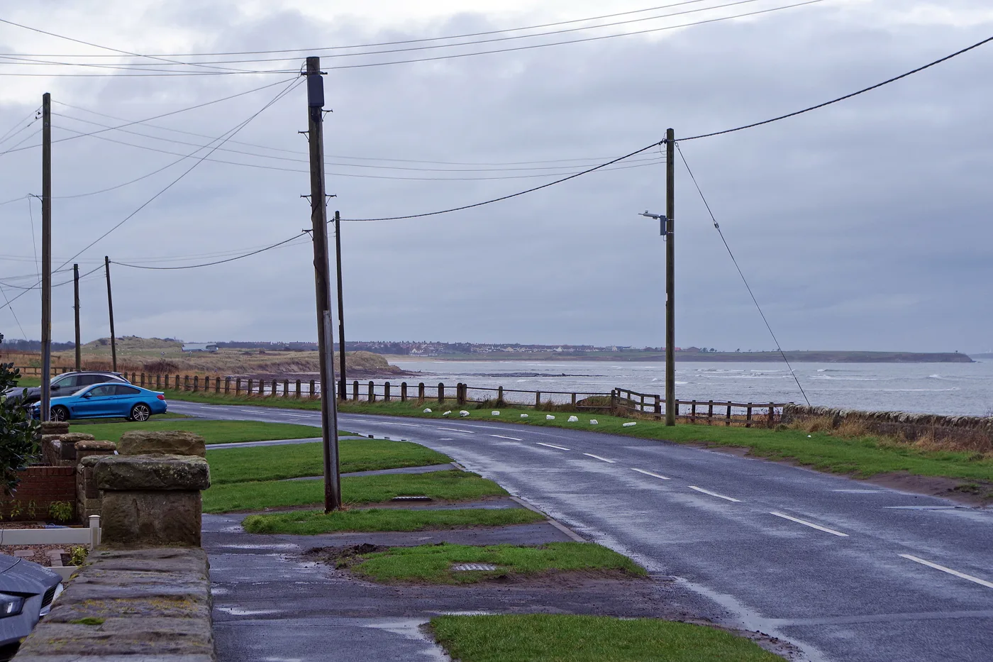

Cresswell's coastal road slope scheme is finished and 195 metres of Beadnell seawall is close behind. Traffic management stays on Harbour Road until it is done.
Two Northumberland villages are getting their sea defences finished, and one of the two jobs is already done.
Northumberland County Council says the Cresswell Coastal Road Slope Management Scheme is complete and the Beadnell Coastal Protection Scheme is on schedule, in an update published on 21 August. Temporary traffic management stays on Beadnell’s Harbour Road until the work there is fully finished, which covers this bank holiday weekend.
What Cresswell got
The completed scheme sits next to the coastal road near Golden Sands Holiday Park. It included:
- stabilising the slope beside the road
- new rock armour along the shoreline
- repairs and improvements to roadside drainage
What Beadnell is getting
The Beadnell scheme is a repair job on a wall that is already there, along Harbour Road:
- 195 metres of existing seawall repaired and strengthened
- 125 metres of the parapet wall on the landward side carefully dismantled and repaired
- repointing and strengthening works to key areas
Harbour Road is the main route through the village to the harbour, the beach and the caravan parks. The council says the work safeguards that road and more than 200 residential properties.
Councillor John Riddle, cabinet member for rural and environment, said the schemes “will bring many benefits to our coastal communities” and thanked the public for their patience while the work has been carried out.
The council has not published a cost for either scheme, and we could not find one in its own published material today.
The council is not obliged to defend any of this
Northumberland’s coastline runs about 132km, or 82 miles, from the Scottish border down to Seaton Sluice. The council is a coast protection authority under the Coast Protection Act 1949.
It also states plainly, on its own coast protection page, that it “does not have a legal obligation to protect any of its coastline from erosion”.
That is why the shoreline management plan matters. It is the document that decides which stretches get defended and which are left to the sea.
What the shoreline plan says about these two places
The Northumberland and North Tyneside Shoreline Management Plan sets a policy for every stretch of coast across three horizons: 2025, 2055 and 2105. It is a large PDF. Four policies are used:
- Hold the Line, maintaining or upgrading the defences that are there
- Advance the Line, moving the defence seaward
- Managed Realignment, letting the shoreline move back in a controlled way
- No Active Intervention, not investing in defence at all
Cresswell is policy unit 17.5, in the Beacon Hill to Cresswell management area. It is Hold the Line in all three horizons (page 202 of the plan). The plan’s stated intent there is “to maintain the function of the village through continued defence”.
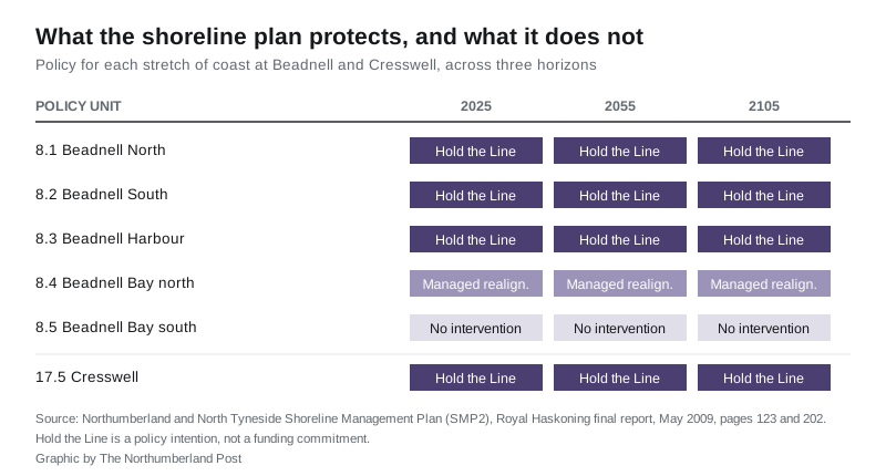
Beadnell is management area 8, and it is split five ways (page 123):
| Policy unit | 2025 | 2055 | 2105 |
|---|---|---|---|
| 8.1 Beadnell North | Hold the Line | Hold the Line | Hold the Line |
| 8.2 Beadnell South | Hold the Line | Hold the Line | Hold the Line |
| 8.3 Beadnell Harbour | Hold the Line | Hold the Line | Hold the Line |
| 8.4 Beadnell Bay north | Managed Realignment | Managed Realignment | Managed Realignment |
| 8.5 Beadnell Bay south | No Active Intervention | No Active Intervention | No Active Intervention |
So the village and the harbour are defended for the next eighty years on paper, and the bay behind them is not. The plan’s comment against unit 8.1, the stretch the current works sit on, is to “control development seaward of the harbour road”. Against 8.5 it notes a “potential increase of flood plain”.
What it means for you
If you are driving into Beadnell over the bank holiday weekend, expect temporary traffic management on Harbour Road. The council calls it the main route through the village to the harbour, the beach and the caravan parks, so allow extra time.
At Cresswell the work is finished and the coastal road is back to normal.
If you own or are buying property on either frontage, the shoreline management plan is the document that tells you what is protected and for how long. Hold the Line is a policy intention, not a guarantee of funding, and the plan itself is a 2009 document that predates the current schemes.
Our Northumberland roadworks and travel page carries the rest of this week’s closures, and things to do in Northumberland has what is on across the county.
Have your say